History
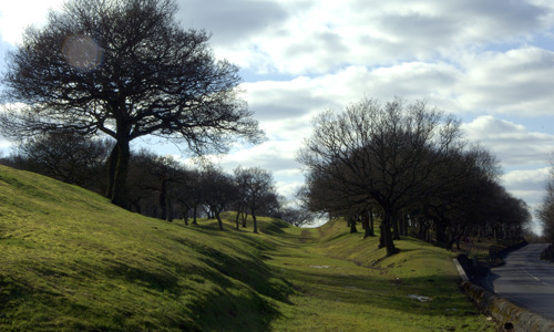
The ditch between Westerwood and Castlecary forts is one of the longest continuous stretches of the Antonine Wall that can be seen today.
- Along this stretch of the wall, there were once:
- two temporary camps
- a circular enclosure
- possibly a watchtower of uncertain date
Frontier of an empire
The Antonine Wall was the Roman Empire’s north-western frontier. Built on the orders of Emperor Antoninus Pius in the years following AD 140, it ran for 37 miles (60km) across Scotland’s central belt, from modern Bo’ness on the Firth of Forth to Old Kilpatrick on the River Clyde.
Rather than a stone wall, the Antonine Wall consisted of a turf rampart 3–4 m high on a stone base, possibly topped with a timber palisade. It was fronted by a wide and deep ditch, much of which is still visible today. Forts along the wall provided accommodation for the troops and acted as secure crossing points. All forts were linked by a road called the Military Way, which ran behind the rampart.
When it was completed, the Antonine Wall was the most complex frontier ever built by the Roman Army. It was the Romans’ last linear frontier, and was only occupied for about 20 years before it was abandoned in the AD 160s.


