All photographs create a record of a moment but aerial photographs are particularly useful in helping us to understand how places are formed, shaped and occupied over time.
From the elevated perspective of a plane, our photographers capture images which both inform our work in the present and serve as a record for the future.
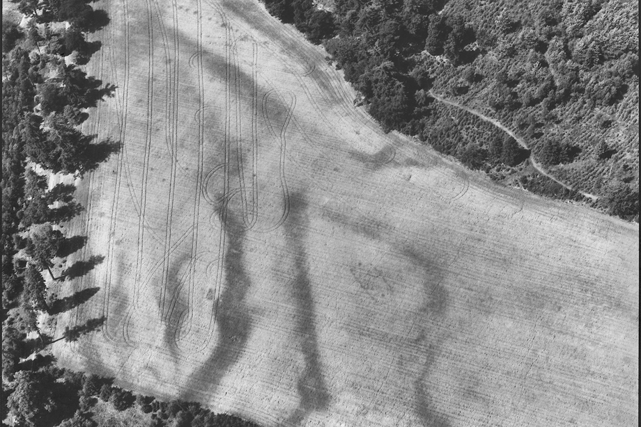
Occasionally changing light or weather reveals new perspectives of natural features and manmade structures, deepening or changing our understanding of the past.
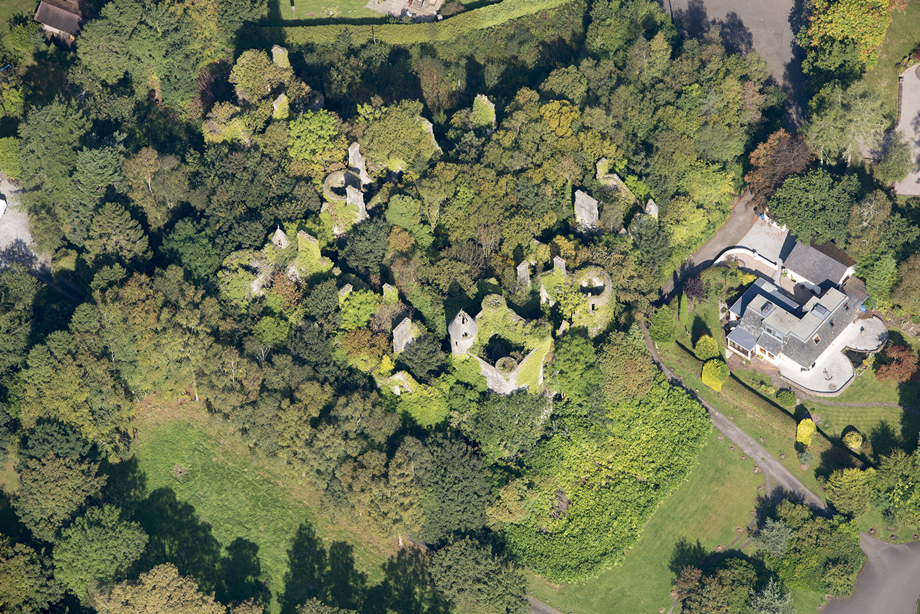
Buchanan Castle, Drymen, Stirlingshire, 2014
Our aerial photography collections in the HES Archives enable us to trace the story of Buchanan Castle from private home, to Second World War military hospital and, today, a scenic ruin after it was abandoned and partially demolished in 1954.
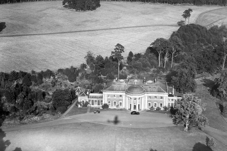
Montgomerie House, South Ayrshire, 1947
This photograph of Montgomerie House was taken on 3 October 1947. The house was gutted by fire in 1969 and later demolished.
The image by the Aerofilms company is now a record of a lost building and changed ways of life, capturing a sunny autumn day when a Post Office telephone engineer parked his Morris Z van on the gravel drive.
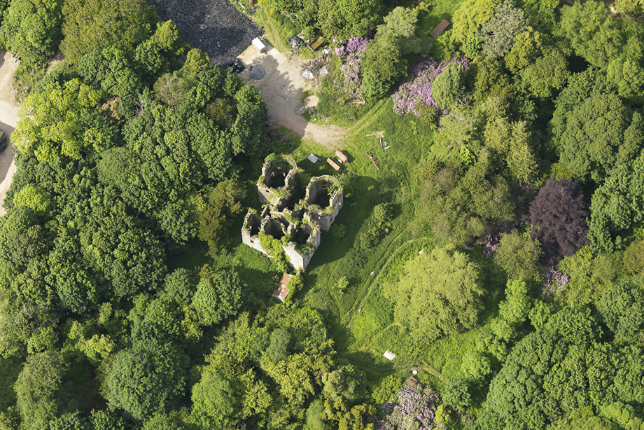
Castlewigg Country House, Whithorn, 2009
Castelwigg was an 18th century country house built on the site of a castle and has been empty since 1954.
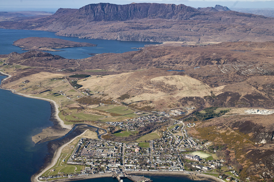
Ullapool, 2007
The town of Ullapool sits in stark contrast with the long ridge of Ben Mor Coigach beyond.
Ullapool was developed as a herring fishing town in 1788 by the British Fisheries Society who commissioned Scottish engineer and architect Thomas Telford to design it.
Castle Kennedy, Dumfries and Galloway, 2008
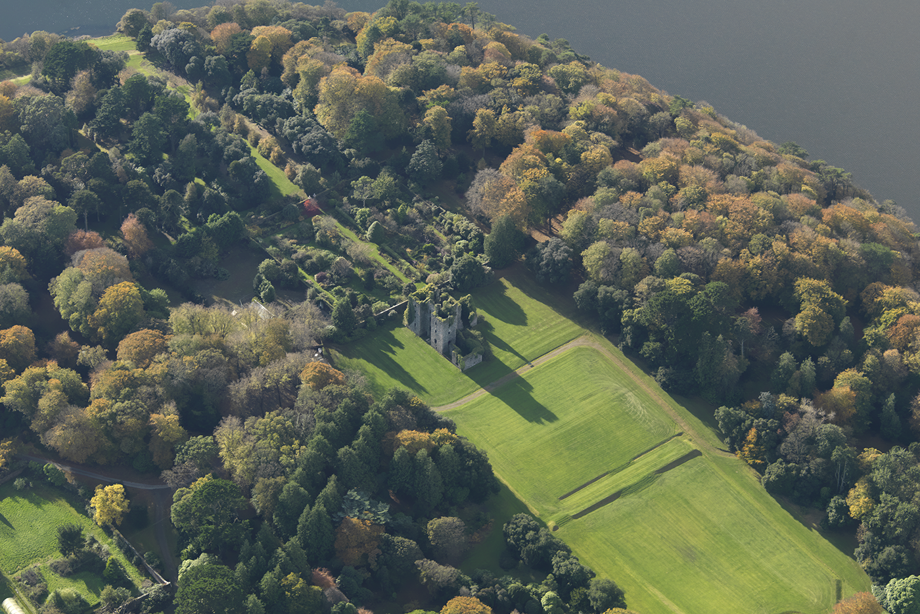
Archaeologist Marilyn Brown used aerial photographs and observation to study the history of lost gardens.
Flying over Castle Kennedy, she saw the patterns of a 17th century garden visible under the 18th century landscape that shapes the castle grounds today.
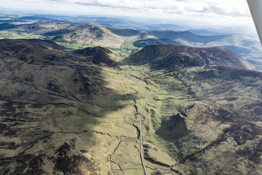
Glen Beag and the Spittal of Glenshee, Perthshire, 2015
The A93 cuts a path south through Glen Beag beside Shee Water. This modern road both sits on and beside the old military road built in a campaign led by Major William Caulfeild after the second Jacobite Rebellion in 1745.
Caulfeild’s campaign was part of the British government’s attempt to re-assert control over the Highlands.
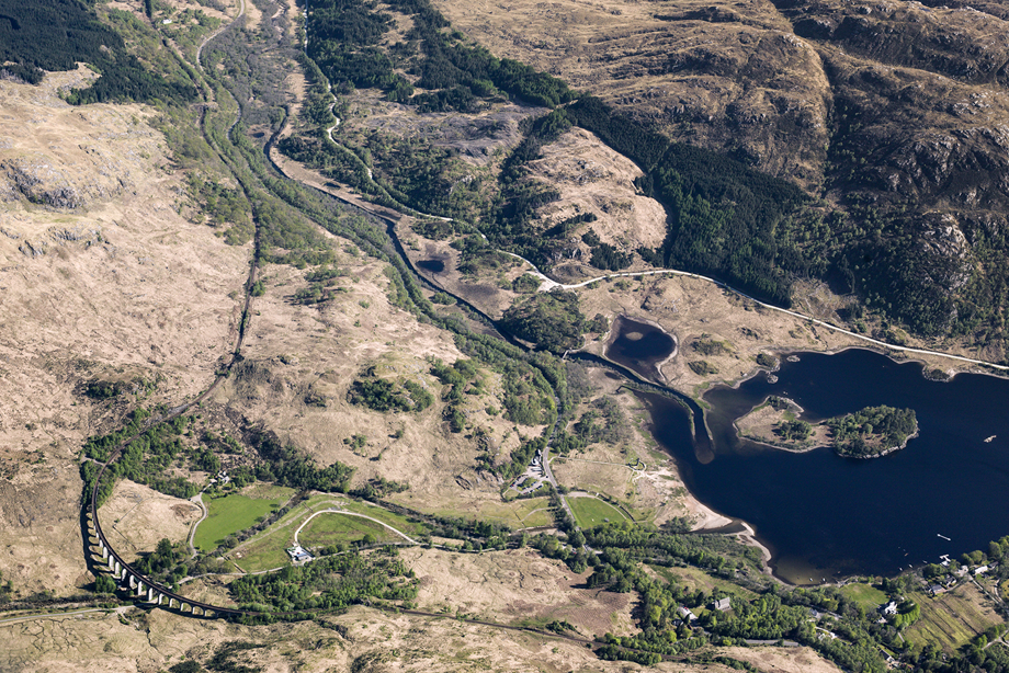
Glenfinnan Viaduct and Loch Shiel, 2011
The West Highland railway line crosses the spectacular Glenfinnan Viaduct beside Loch Shiel. The 21-arch viaduct was completed in 1898 and the first train made the journey between Fort William and Mallaig in 1901.
Already known as one of the world’s most spectacular train experiences, the Viaduct gained wider fame thanks to its starring role in several Harry Potter films.
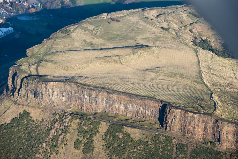
Salisbury Crags, Edinburgh, 2007
Salisbury Crags in Holyrood Park are a familiar Edinburgh backdrop, looking down over the Old Town and just a 10-minute walk from the Scottish Parliament.
But few people have seen them from this angle in low light, revealing evidence of how the land was once used for agriculture.
The Crathes Castle Pits, 1976
This black and white photograph revealed an intriguing pattern of dark spots across a field near Crathes Castle.
In 2004 and 2005, archaeologists used the image to guide their excavation of the site, discovering evidence of a well-preserved Early Neolithic building and a number of evenly-spaced pits (perhaps used as a primitive calendar) dating back to 3800-3700 BC.
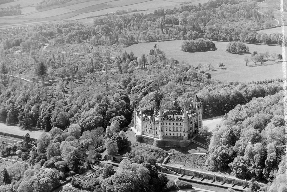
Dunrobin Castle, Sutherland, 1955
Aerial photography captures Dunrobin Castle and its Italian-style gardens both designed by Sir Charles Barry, architect of the Houses of Parliament.
Visiting not long after Barry had finished his modernisation project, Queen Victoria described it as 'A mixture of an old Scotch castle and French chateau'.
Scotland from the Sky continued
Continue your exploration of Scotland's extraordinary landscape from this unique perspective.

