Aerial photography is particularly effective at showing urban change.
Our images of Scottish cities reflect shifting patterns of urban life in the 20th century. Historic buildings and natural features remain unchanged but social, political, economic and cultural forces shape and re-shape our cities.
By looking from the sky, we can see evidence of new communities and new patterns of living and working.
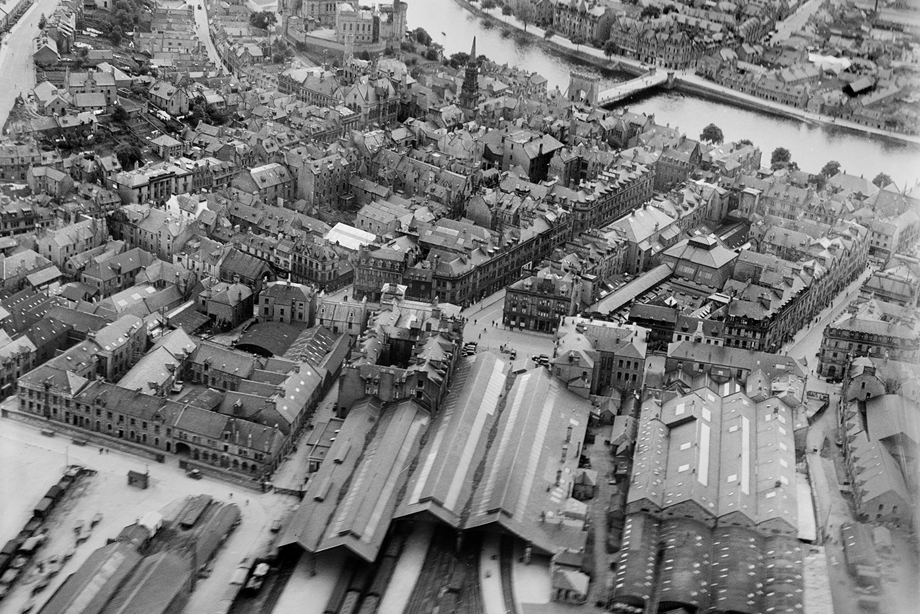
Inverness, 1928
The pitched roofs of the railway station and market hall dominate the lower half of this image while, beyond, the elegant profiles of Inverness Castle, the Steeple and old Ness Bridge are clearly visible.
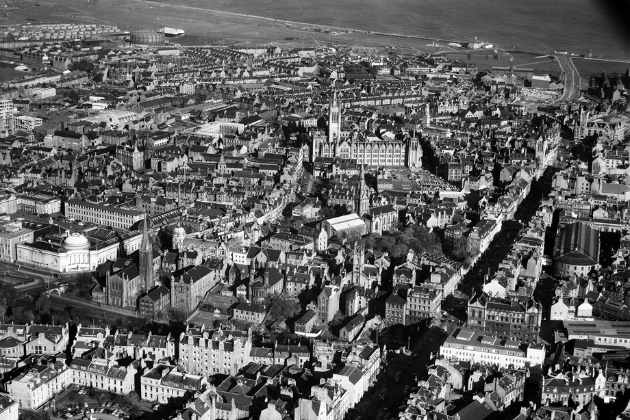
Aberdeen, 1962
Aerofilms photographers captured the elegance of central Aberdeen and the imposing façade and spire of Marischal College.
The strong light picks out the white domed roof of Aberdeen Museum and Art Gallery on the left and the Market building’s rear curved wall to the right. The diagonal line of Union Street lies in shadow.
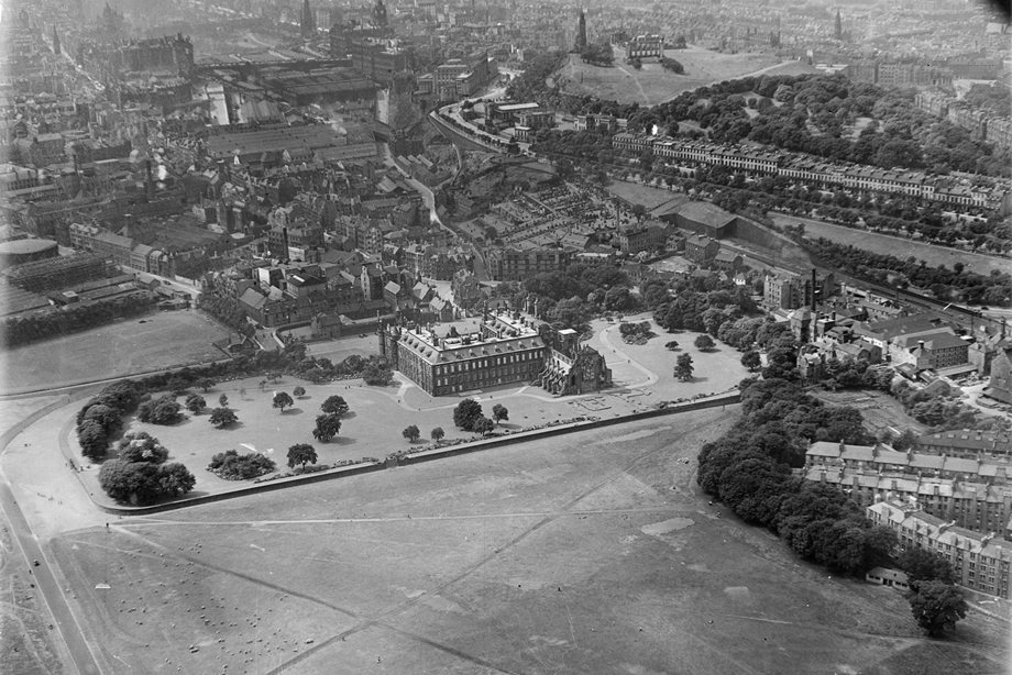
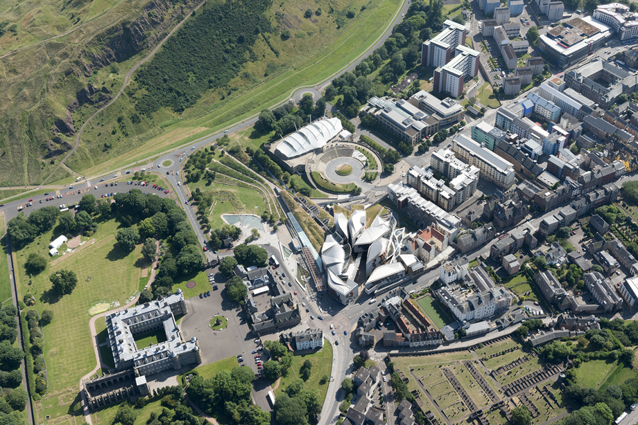
Holyrood House, 1947 - 2014
The Queen’s official residence in Edinburgh was built in the 16th and 17th century beside the remains of a 13th century abbey. In 1947, Holyrood House sat opposite tenements, a brewery and gasworks.
By 2014, the Scottish Parliament building had been operating opposite Holyrood House for a decade, the controversy over its design and construction mostly forgotten.
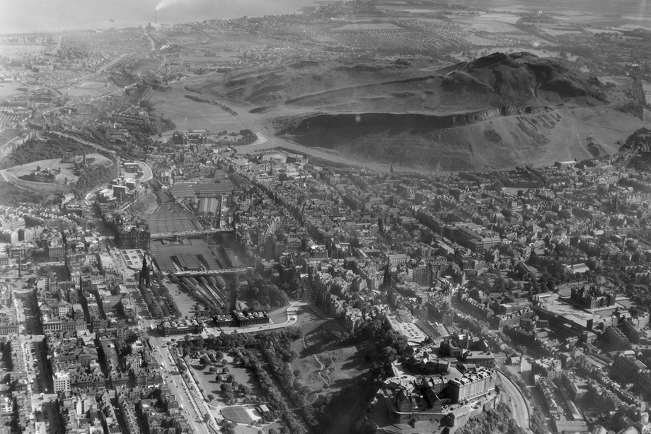
Edinburgh, 1958
This image emphasises Edinburgh’s distinctive geography. Princes Street and its Gardens in the lower part of the picture lead the eye to Waverley Station, Holyrood Palace and the Firth of Forth beyond.
To the right, the Old Town is shaped by Castle Rock and Salisbury Crags.
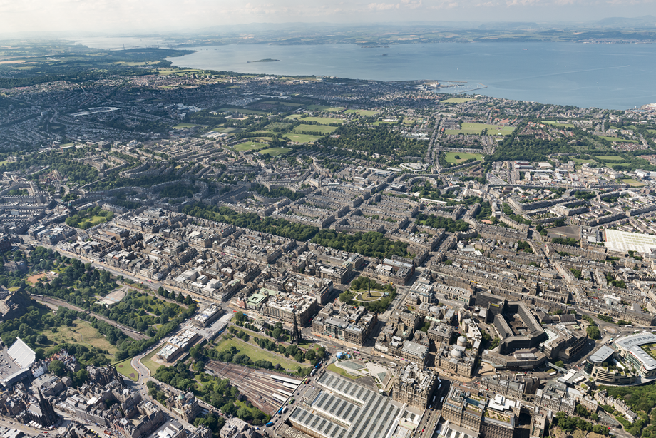
Edinburgh City Centre, Inverleith and Granton, 2014
The view north from above the Old Town takes in Edinburgh’s historic New Town, St Andrews Square and the Royal Botanic Gardens beyond.
On the lower right, the image captures St James' Shopping Centre and the 1970s brutalist New St Andrew’s House before they were demolished in 2017.
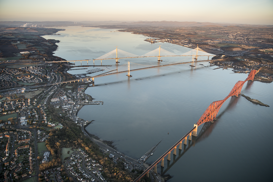
Forth Bridge, January 2017
Soft winter light reveals three feats of engineering across the Firth of Forth. The Forth Bridge opened in 1890, carrying trains across the longest structure of its kind in the world. The 1964 Forth Road Bridge was the world’s biggest suspension bridge outside the USA.
The 1.7 mile-long Queensferry Crossing is the longest three-tower, cable-stayed bridge in the world. At the time of this image, it was still a work in progress, with a final gap to be closed on the south (left) side.
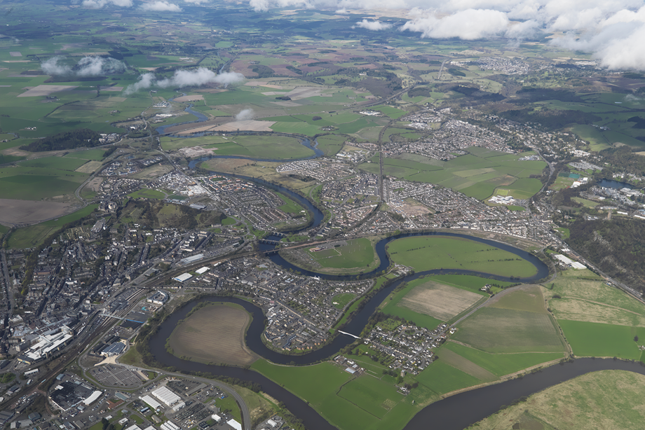
Stirling, 2010
The River Forth winds its way around the Raploch housing scheme and Stirling County Rugby Club before heading towards the town centre beside the railway station.
This photographic angle shows Stirling in its landscape and urban context rather than the more familiar views of Stirling Castle.
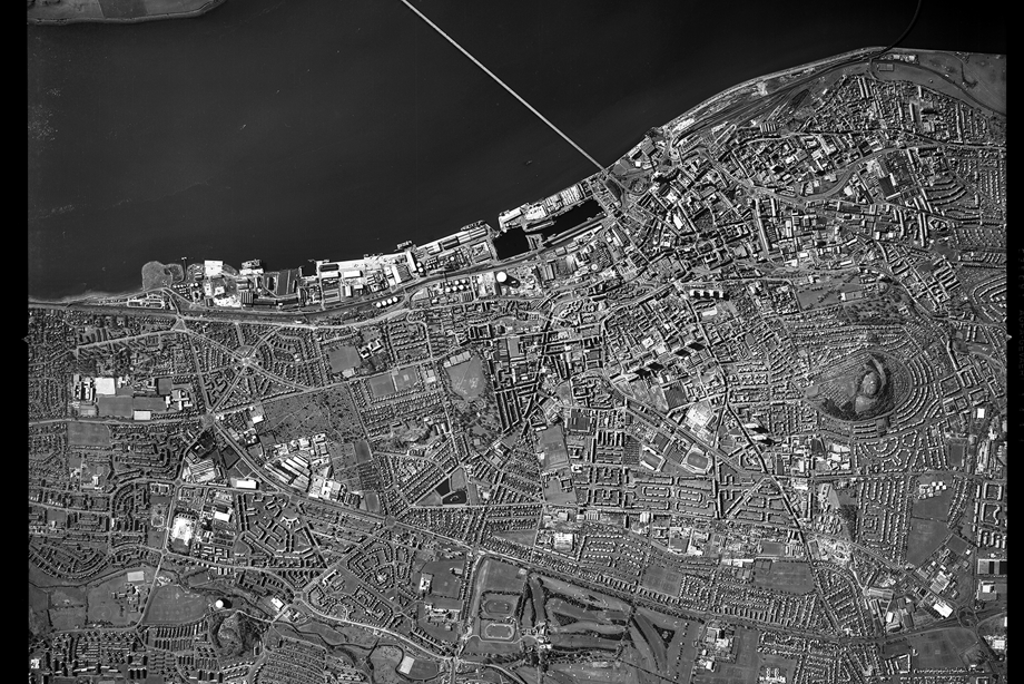
Dundee, 1988
The distinctive circular shape of Dundee Law frames this image to the west as the Tay Rail and Road Bridges cross from the south. In 1988, when this photograph was taken, the waterfront was in a state of transition.
To the left of the Tay Road Bridge, the RRS Discovery (which travelled to Antarctica with Robert Scott and Ernest Shackleton on board) is not yet in its dry dock. Thirty years later in 2018, V&A Dundee opened on the waterfront nearby.
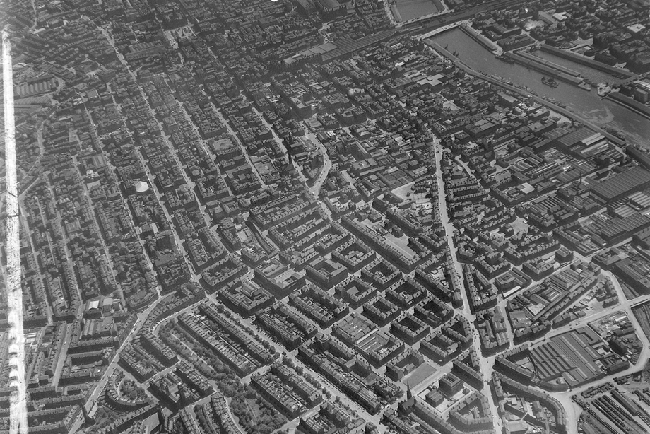
Glasgow, 1955
The railway bridge into Central Station is a familiar landmark in an image where so much has since changed. Above is the curved roof of St Enoch Station, demolished in 1977.
To the left, George Square stands out as a rare open space. On the right, Argyle Street makes a sharp bend as it heads to the West End.
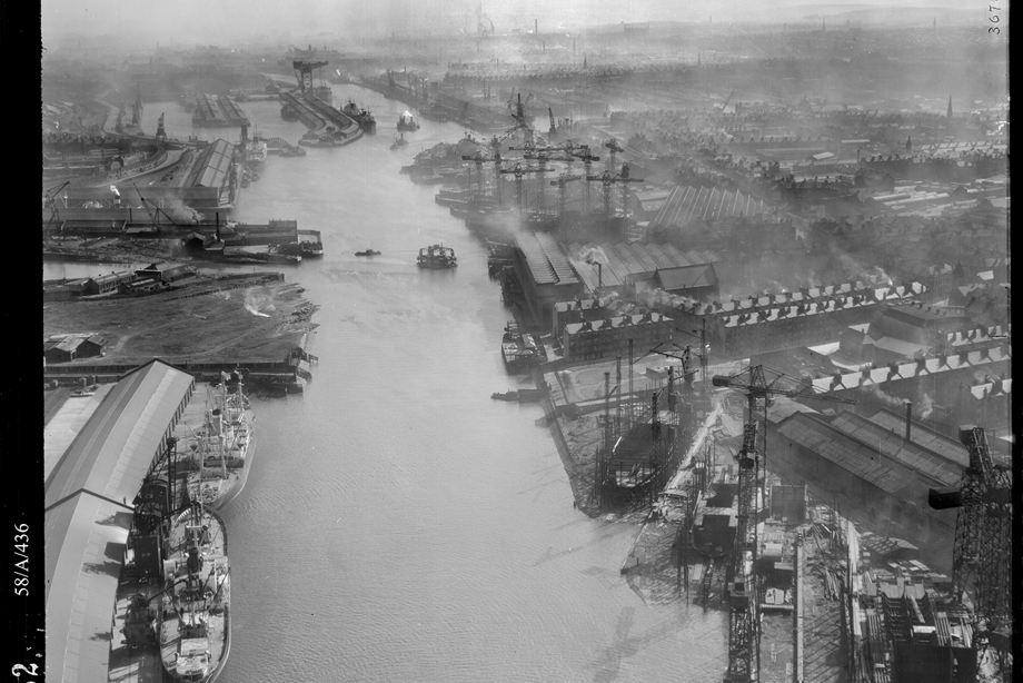
River Clyde looking east, Glasgow, 1950
The cranes of Fairfield’s and Harland & Wolf shipyards line the south side of the River Clyde as far as Prince’s Dock (now the site of BBC Scotland and the Glasgow Science Centre).
Opposite, on the north side, the Finnieston Crane handles cargo at the Queen’s Dock. On the water, the distinctive two-storey Govan vehicle ferry prepares to dock.
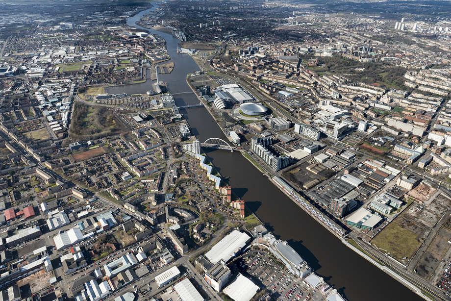
River Clyde looking west, Glasgow, 2015
The stepped roofline of the SEC Armadillo and the circular dome of SSE Hydro occupy the space where Queen’s Dock once serviced ships from around the world.
The Finnieston Crane – between the Hydro and the river – and the Govan Graving Docks on the south side are some of the last reminders of the River Clyde’s historic waterfront.
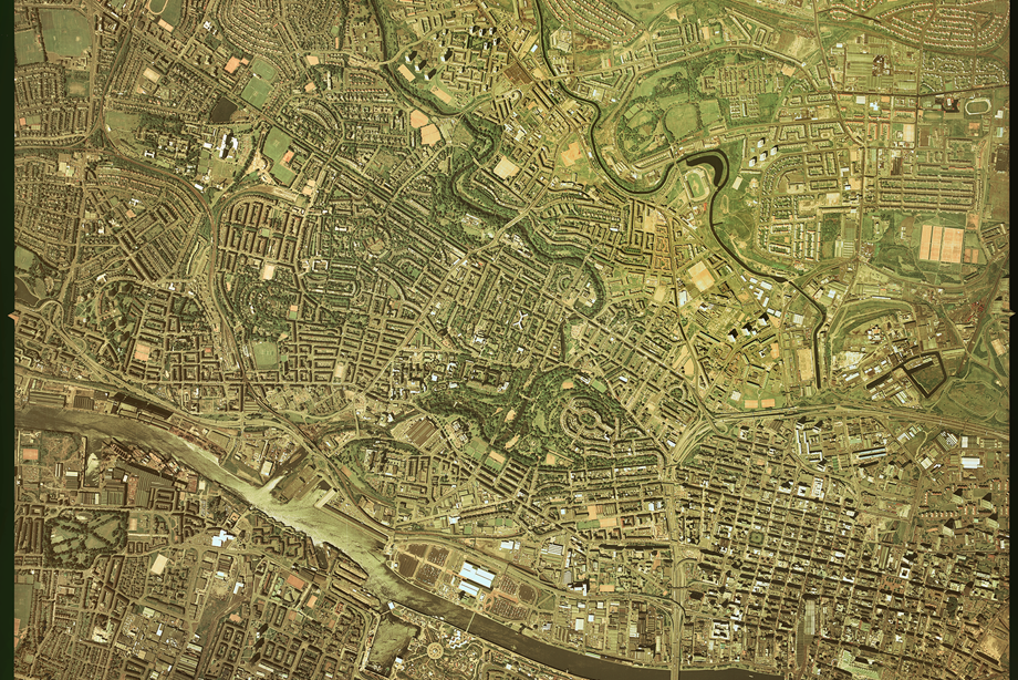
Glasgow, 10 June 1988
This image captures Glasgow’s city centre grid pattern, the tree-lined paths of Kelvingrove Park and the snaking routes of the railway, River Kelvin and the Forth and Clyde canal (its distinctive crescent-shaped basin wrapping round Partick Thistle’s home ground at Firhill).
South of the river, Glasgow’s Garden Festival is in full swing.
Scotland from the Sky continued
Continue your exploration of Scotland's extraordinary landscape from this unique perspective.

